- Home ::
- Explore
Waterbug Data Portal
These maps bring together data from water authorities around Australia, and model it so that it shows site assessments that are comparable with those that you can do using The Waterbug App.
Eventually, the data submitted from the app will sit alongside these assessments, but in the meantime, explore your catchment. Where looks healthy, where needs help?
A detailed description of how SIGNALT scores (the numbers behind the dots) were created, and how to interpret them can be found here www.waterbugblitz.org.au/signalt
Click on site markers in the map for specific rivers, lakes or wetlands. There is a search box you may also find helpful if you are looking for a particular waterway name eg Avoca River. Don’t forget to click the Go button.
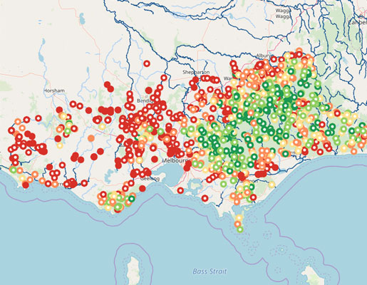
Victoria
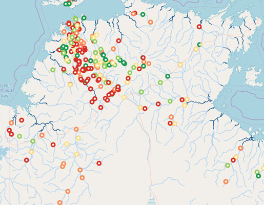
Northern Territory
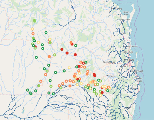
Queensland
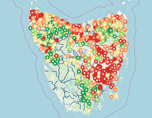
Tasmania
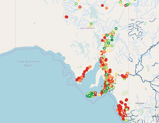
South Australia
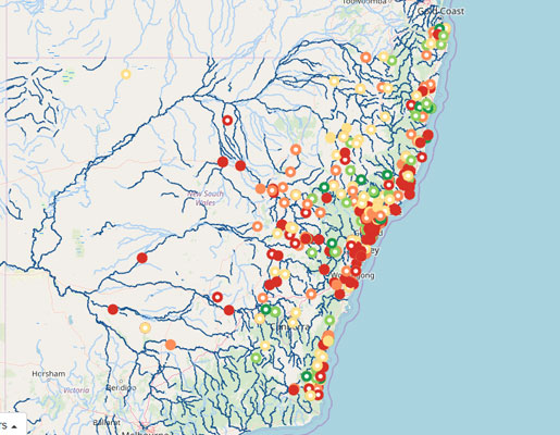
New South Wales
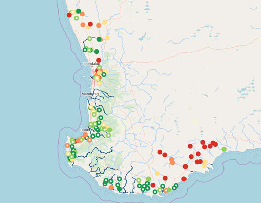
Western Australia
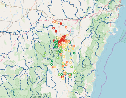
Australian Capital Territory